Cahokia Mounds
After visiting The Gateway Arch I decided to visit an ancient archaeological site. It is just 11 minutes from the RV park at DraftKings Casino which is amazing when you see how big St Louis is. However, it is on the Illinois side which is nowhere near as developed.
I had stopped by there before getting to the RV park a couple of days ago but the heavens decided to erupt in spectacular fashion. It rained so hard when I got there, I couldn’t see outside the windscreen. As it is all mostly outdoors, and the museum was shut, it was a bit of a washout. See what I did there?
Anyway, I packed and left the RV park early and in a hurry as it was cloudy but it wasn’t supposed to rain till about 10 am, so I went back to Cahokia Mounds hoping I could beat the rain this time.
The History
A little bit of fascinating history for you (well I’m a nerd and I think it’s fascinating LOL):
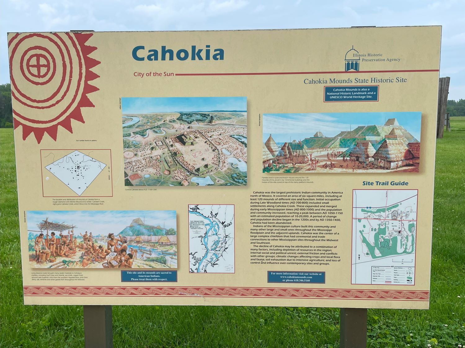
Cahokia was the largest prehistoric Indian community in America north of Mexico. It covered an area of 6 square miles, including at least 120 mounds of different sizes and functions. Initial occupation during late woodland times [AD 700-800] included small settlements along Cahokia Creek. These expanded and merged during early Mississippian times [AD 800-1000] and the population and community increased, reaching a peak between AD 1050-1150 with an estimated population of 10-20,000. A period of change and population decline began in the 1200s and by AD 1350-1400, Cahokia had been abandoned.
Amazing how civilizations come and go.
There are many large and small Mounds throughout the Mississippi floodplain. Cahokia was the center of a large complex chiefdom that had ceremonial and trade connections to other Mississippian sites throughout the Midwest and southeast.
The Decline
There’s lots of possible reasons the Cahokia declined, including depletion of resources; internal social and political unrest; external friction and conflicts with other groups; climatic changes affecting crops; soil exhaustion due to intensive agriculture; and loss of control and influence over contemporary sites and groups.
Personally, I think as with a lot of sites and civilizations, we’ll never know why they left but I’m sure we can speculate ad infinitum!
Monks Mound is the easiest to climb as it has steps to the top. However, it’s a lot of steps, and while I was there all these athletic types were running up and down them. ME? I had to stop at the top of each set and get my breath back! I pretended to look around to see the view, good excuse as it was pretty amazing.
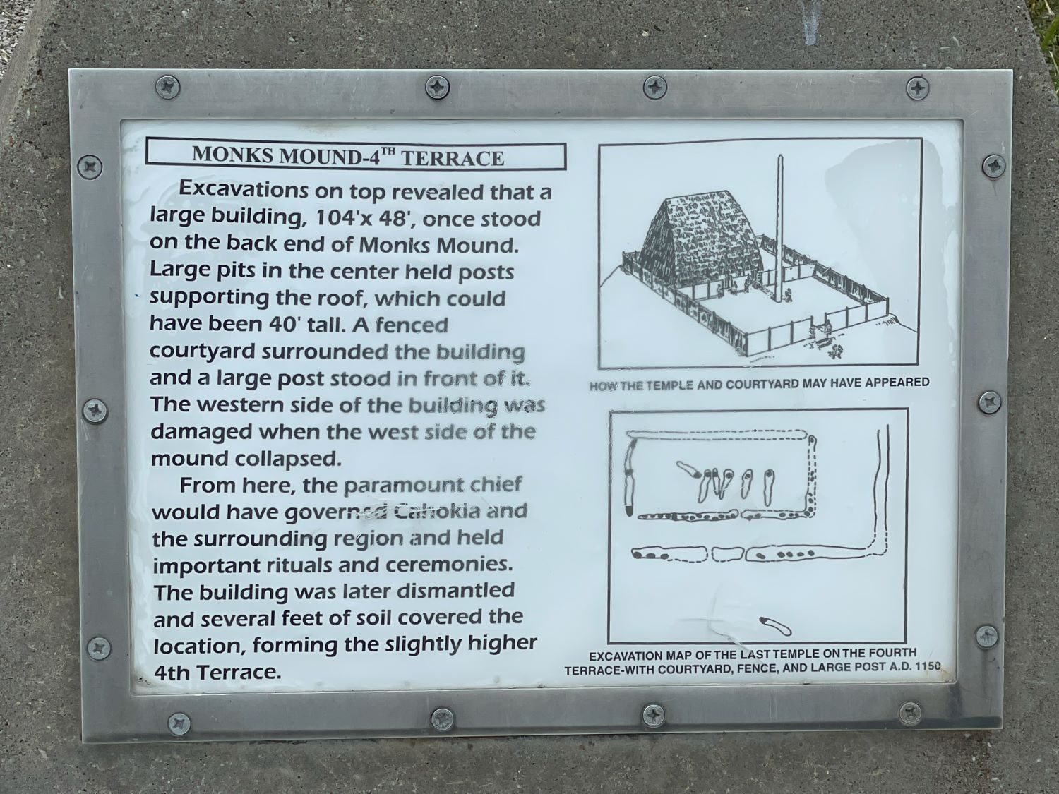
Monks Mound 4th Terrace
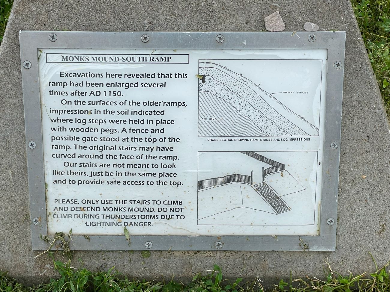
Monks Mound South Ramp
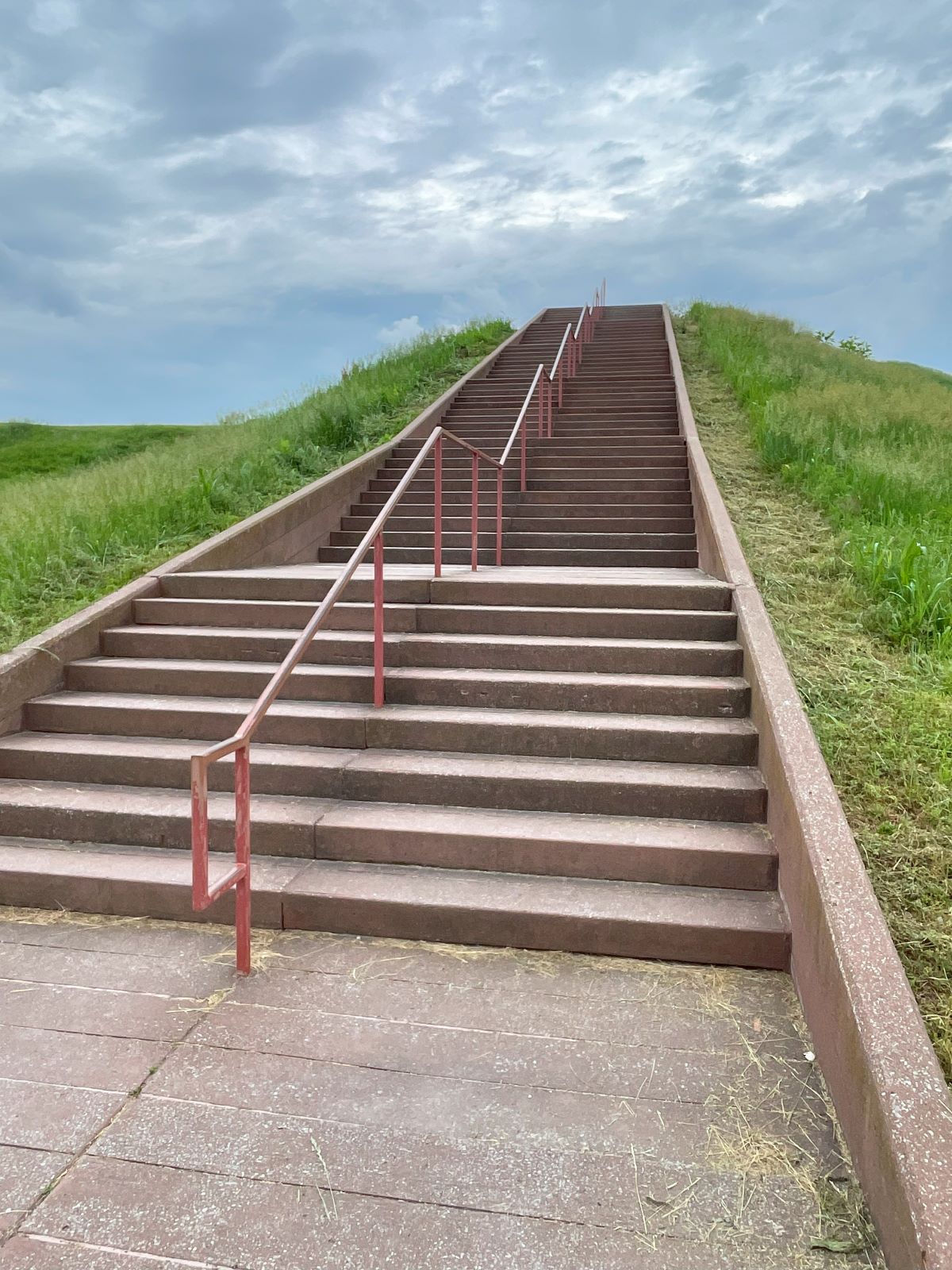
First Set of Steps
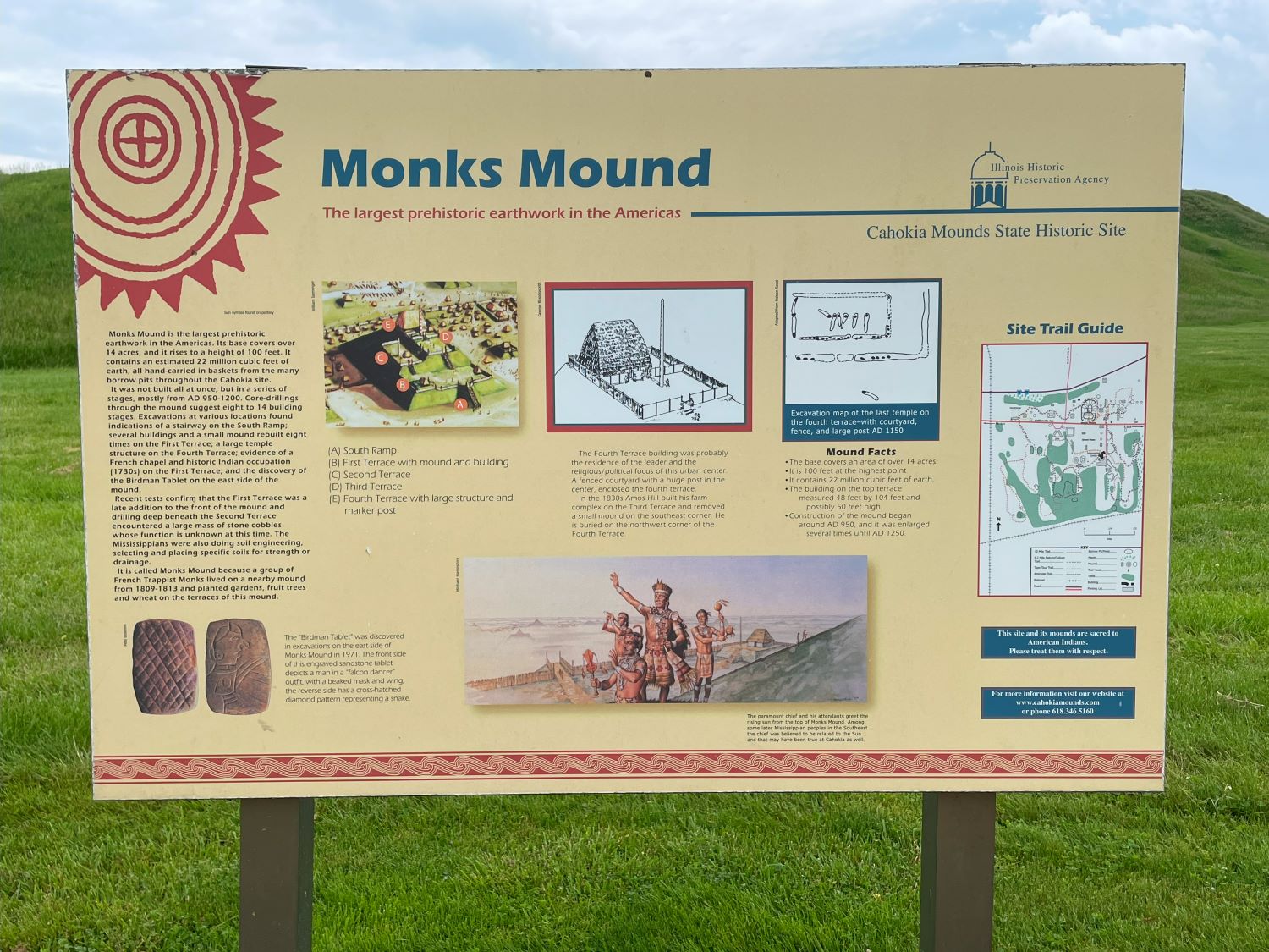
It is the largest prehistoric earthworks in the Americas. Its base covers over 14 acres, and it rises to a height of 100 feet which is why there are so many steps. It contains an estimated 22,000,000 cubic feet of earth, all hand-carried in baskets from the many borrow pits throughout the Cahokia site. I can barely climb the stairs and these guys build this whole thing using baskets!
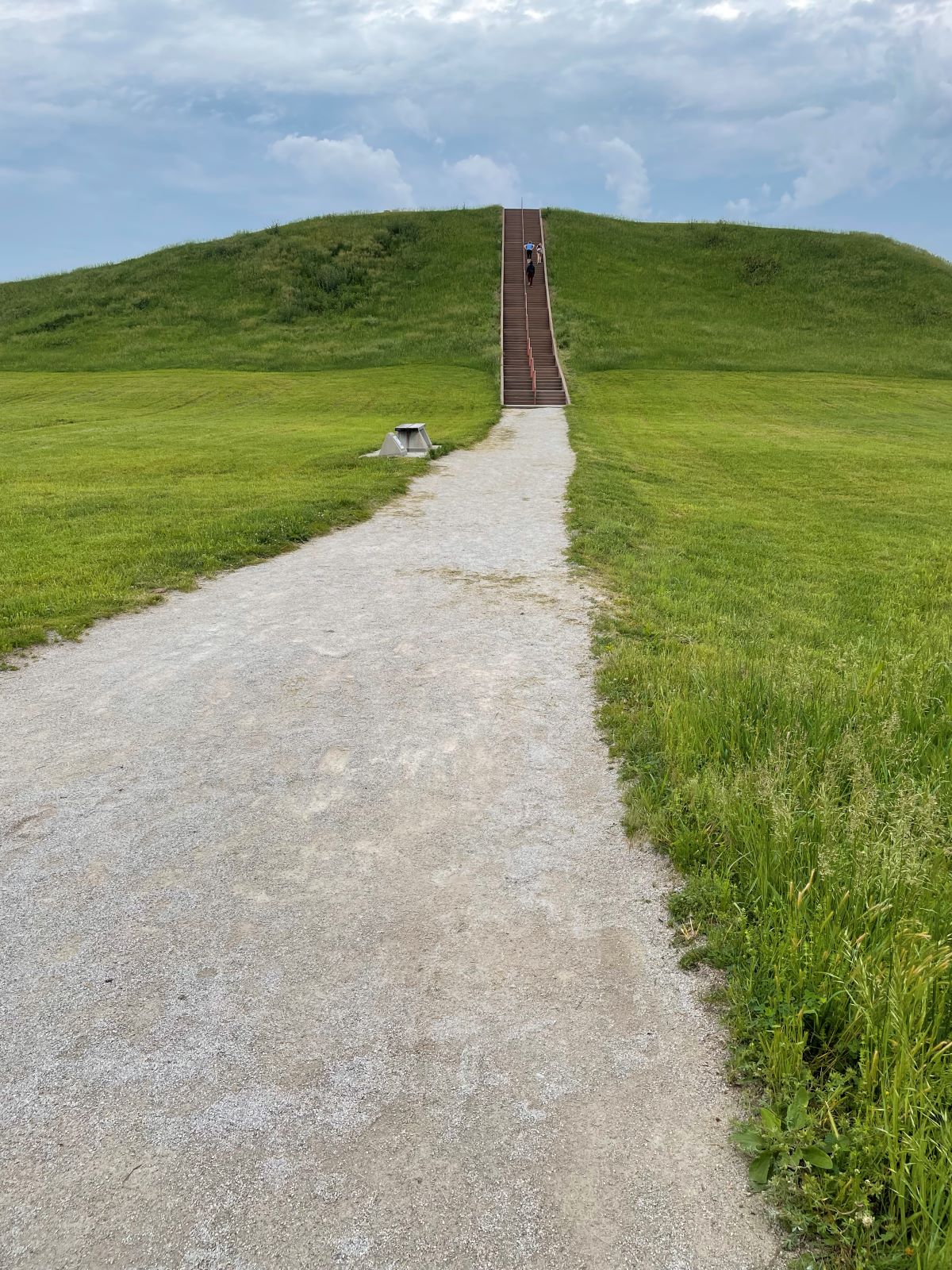
Second Set of Steps
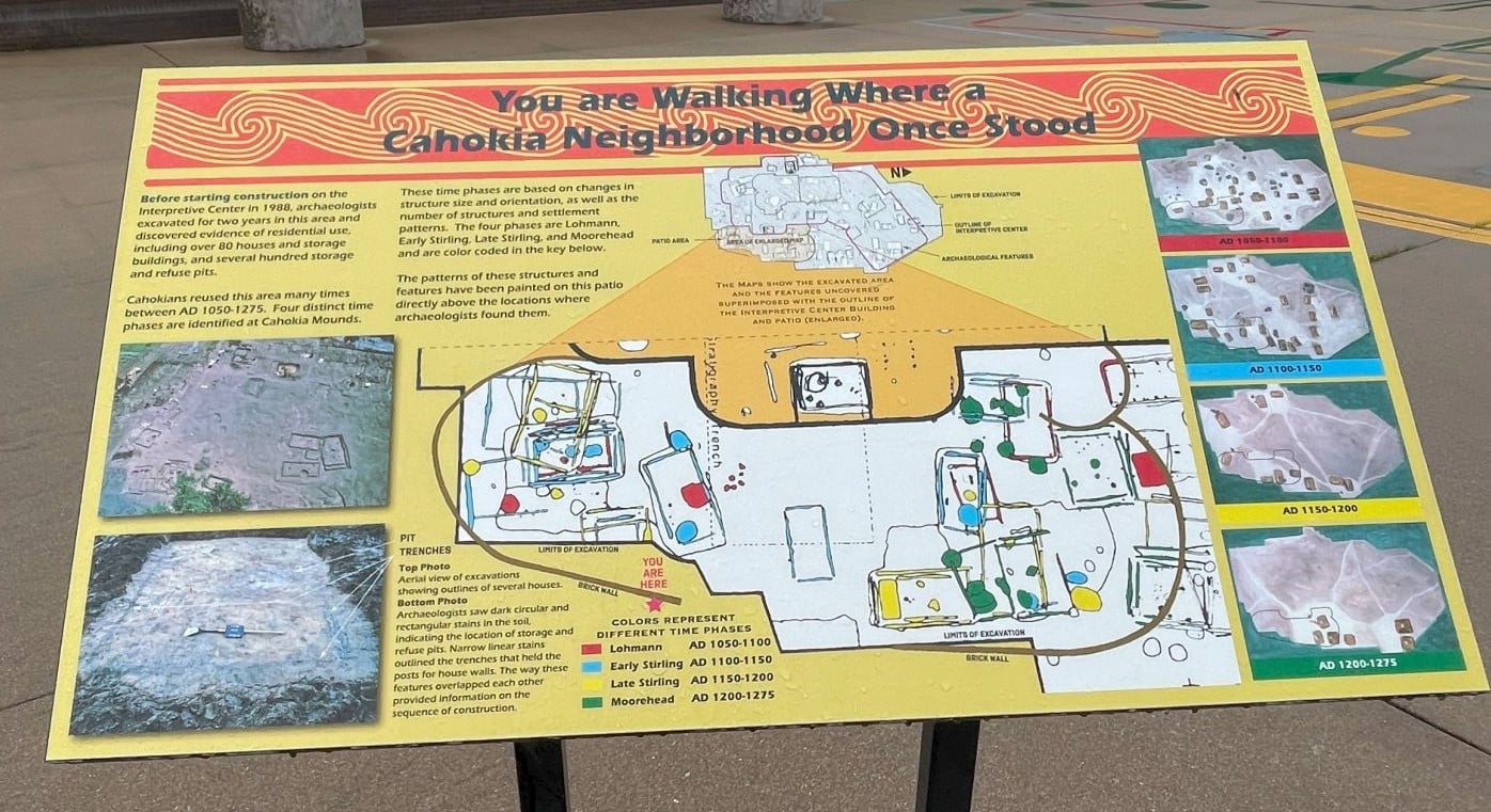
Excavations
Apparently, it wasn’t built all at once, but in a series of stages, mostly from AD 950-1200. Core drillings through the mound suggest 8 to 14 building stages. Excavations at various locations found indications of a stairway on the South ramp which is where the Illinois Department of Natural Resources erected a staircase to the top.
There appears to have been several buildings and a small mound rebuilt 8 times on the 1st terrace; a large temple structure on the 4th terrace; evidence of a French Chapel and historic Indian occupation (1730s) on the 1st terrace; and the discovery of the Birdman Tablet on the east side of the mound. I’ve added a picture of the Birdman, just looks like a guy with a hooked nose to me but then I’m no Archeologist.

Birdman Sandstone Tablet
What is amazing to me is these Mississippians, a thousand years ago, were also doing soil engineering, selecting and placing specific soils for strength or drainage. We can’t seem to get that right in some places now with all our technology.
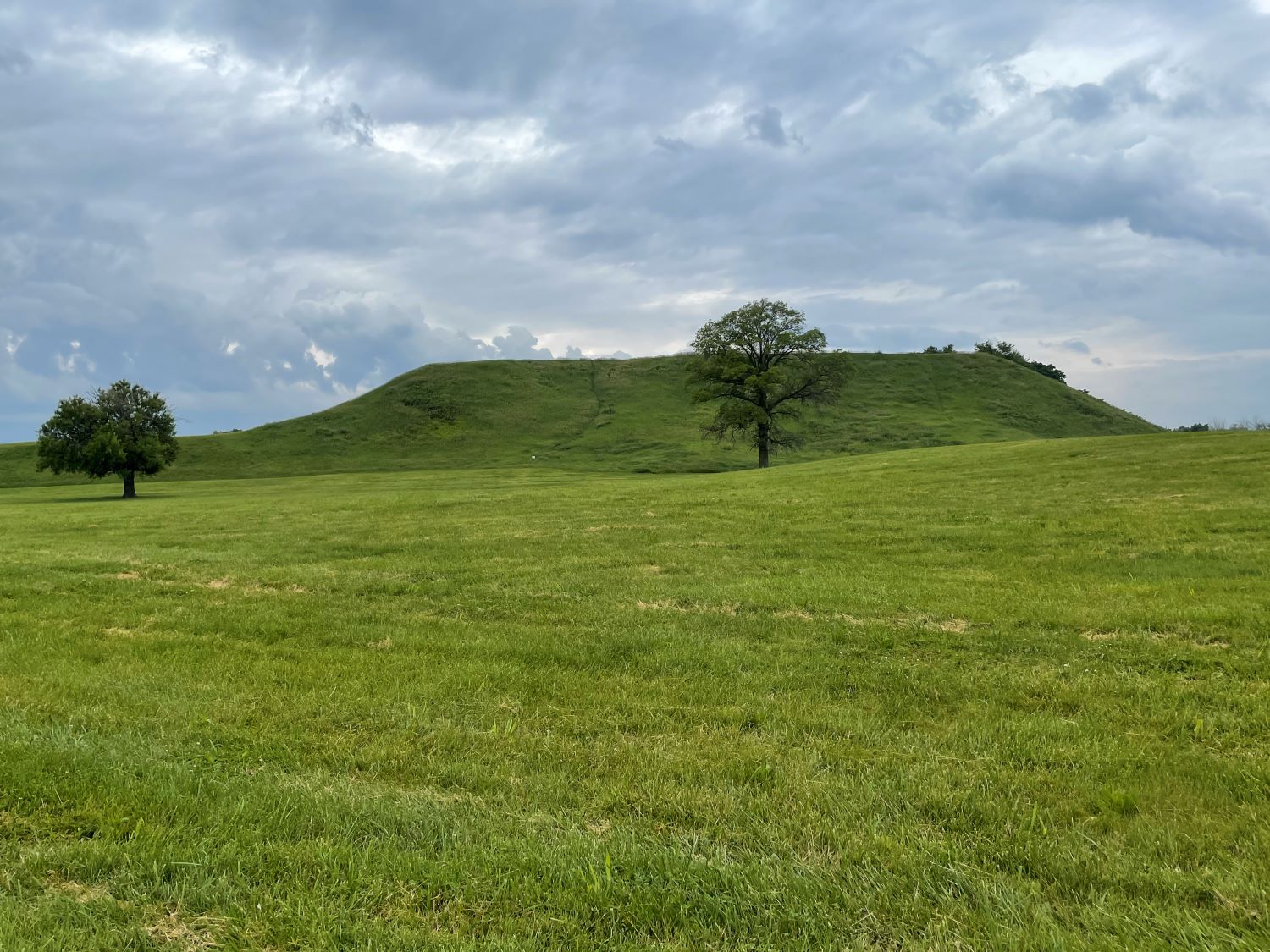
Monks Mound
And, the reason it’s called Monks Mound was because a group of French Trappist Monks lived on a nearby mound from 1809-1813 and planted gardens, fruit trees, and wheat on the terraces of this mound.
There endeth the lesson!
Here’s some views from the top of Monks Mound.
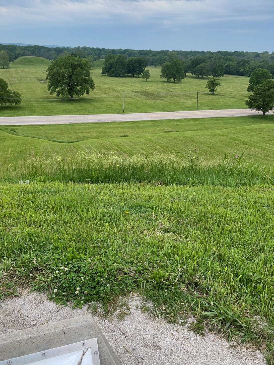
Grand Plaza Looking South, you can easily see more mounds on the other side of the road.
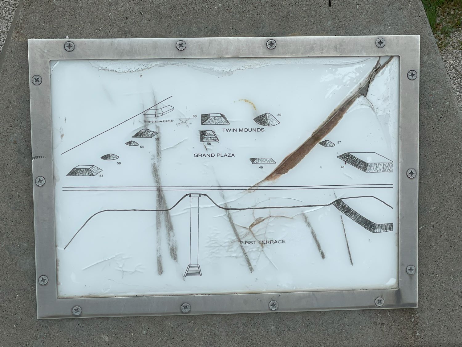
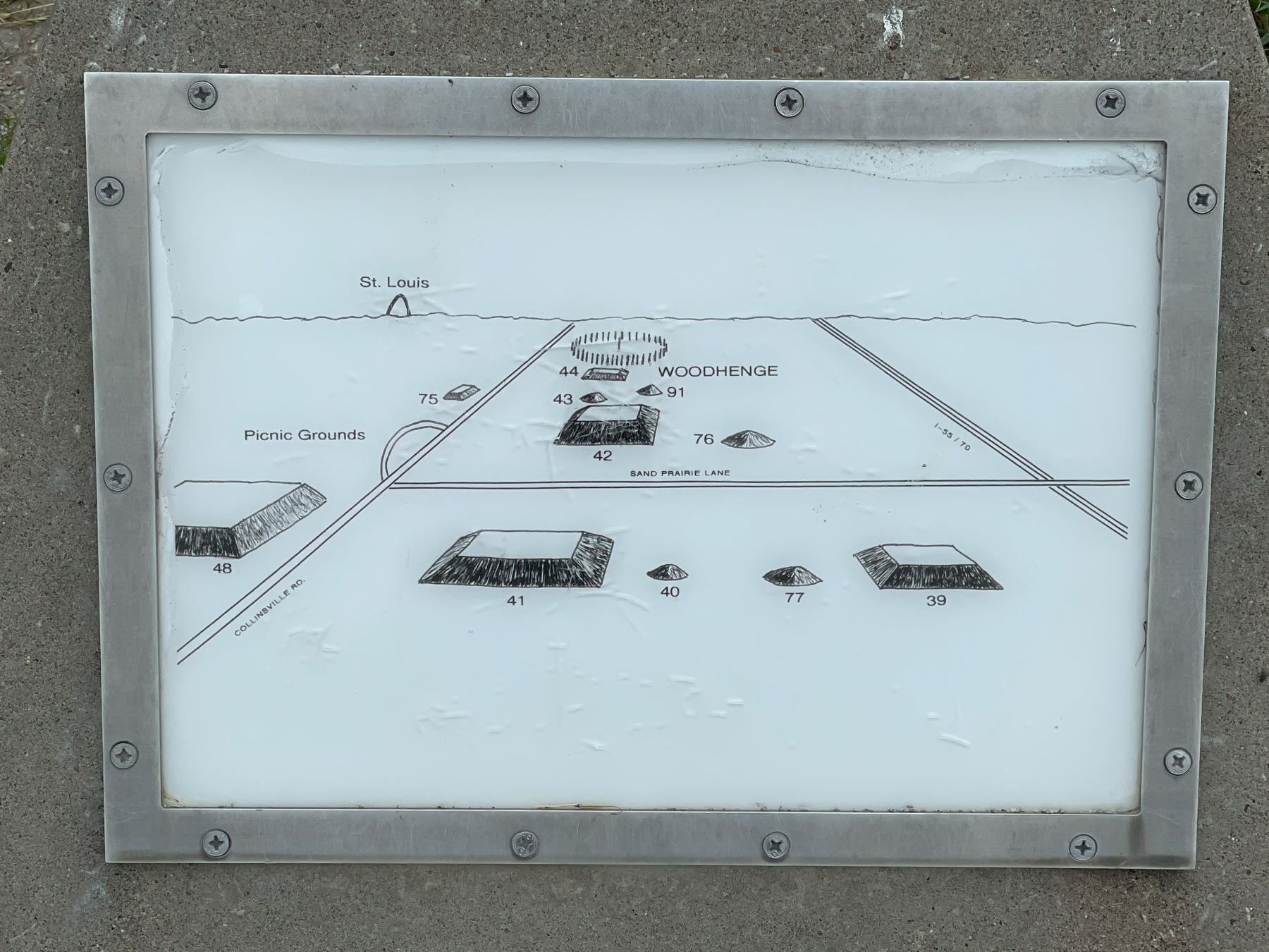
This sign details the mounds across the road, the two mounds in the picture above are called ‘Twin Mounds’ in the sign.
Grand Plaza. The ‘building’ in the sign is the museum.
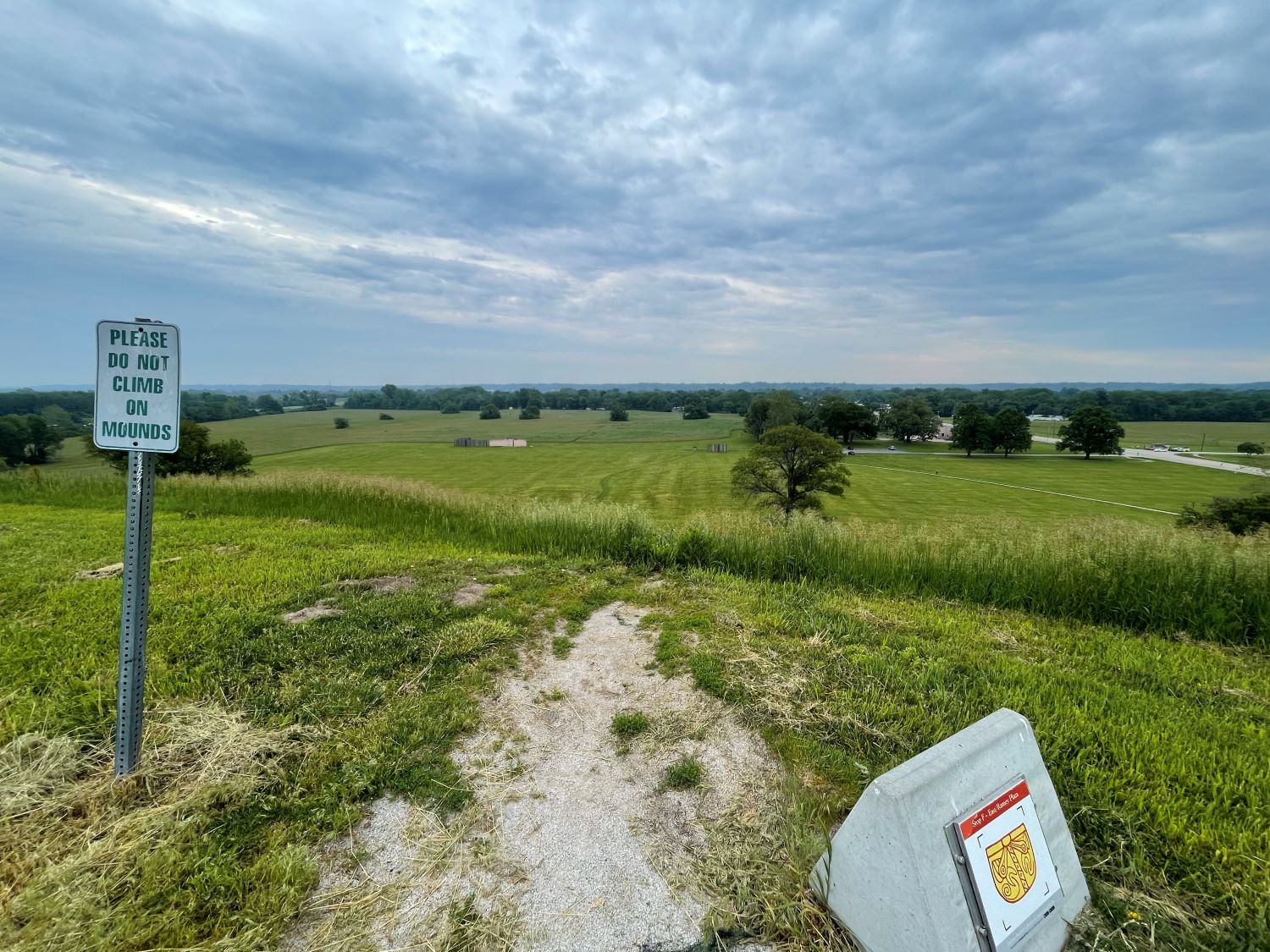
There are two stockades represented by the wooden structures you can see in the distance.
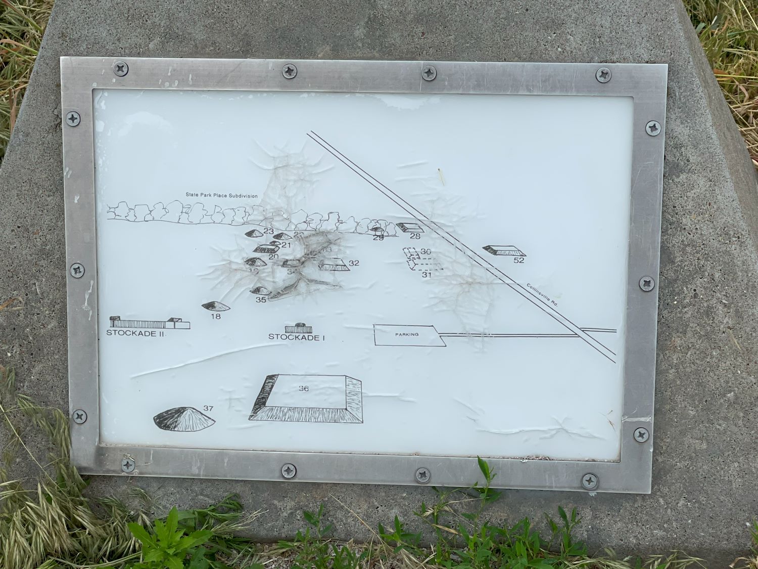
This sign shows where the stockade footings were found and other mounds that are hard to see in the photo above.
As you can see from this photo it was such a clear, bright, and sunny day, NOT! At least you can still see the Arch.
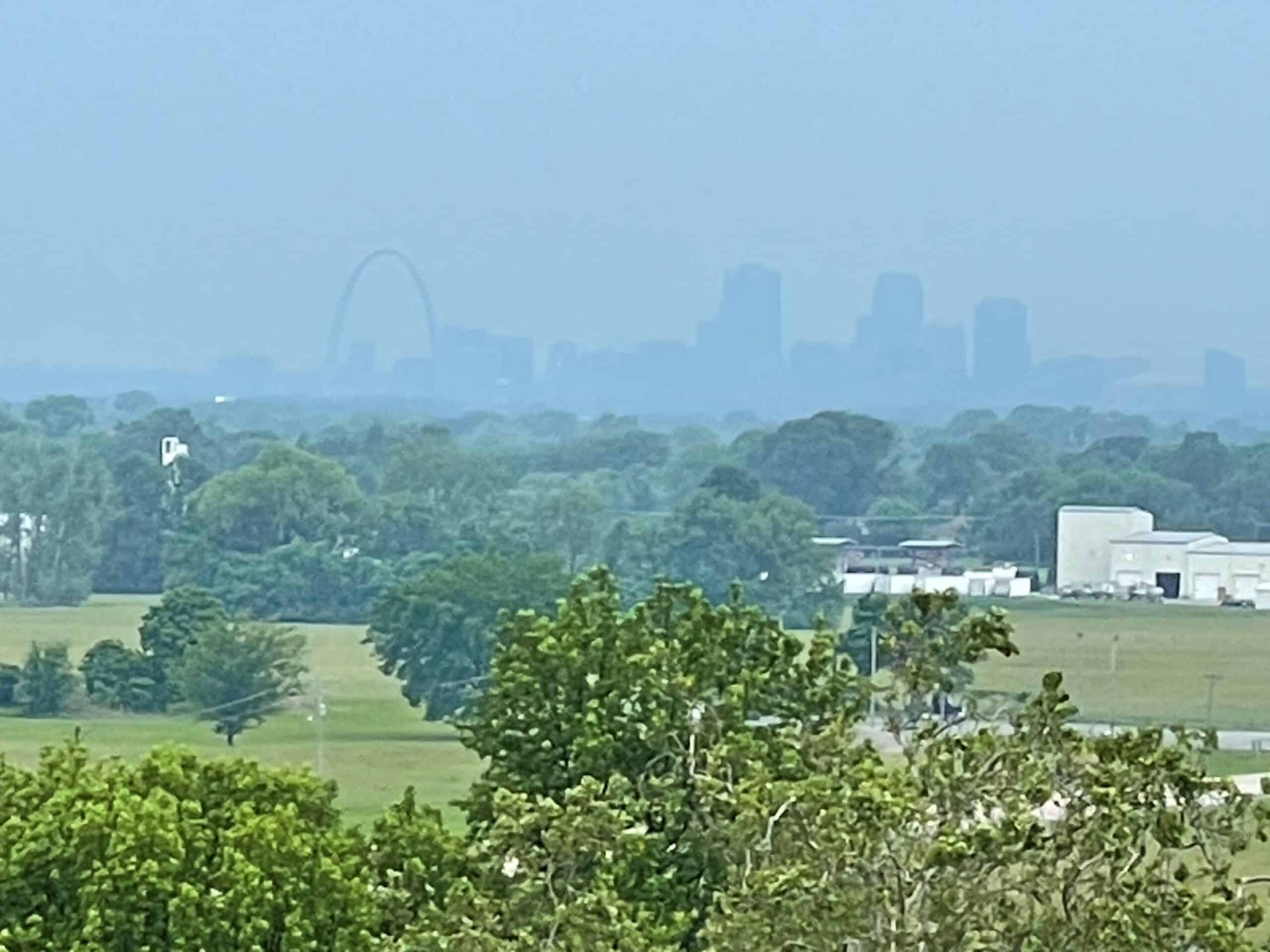
Facing St Louis
This is what the area contained before the Arch or St Louis was even a gleam in someone’s eye.
I drove across the road to the museum side to see some of the mounds there, and again the heavens erupted.
At this point, I gave up and drove to my next destination: Merimac Caves. At least that is indoors out of the rain. Assuming of course it doesn’t rain enough to flood the caves!